Since 2017, California has experienced 15 of the 20 most devastating wildfires in state history. You’ve heard of them, or the towns they’ve affected: the deadly Camp fire in Paradise, the Tubbs fire in Napa and Sonoma counties and the Eaton and Palisades fires this past January that destroyed swathes of the Los Angeles area and killed dozens of people.
Notably, the fires mentioned above didn’t occur during the traditional “fire season” of late summer, nor did they take place entirely in remote, forested areas: many struck urban landscapes.
Wildfires are changing. The climate in which they happen is changing. The consequences are becoming more catastrophic. Frank Frievalt, head of the Wildland-Urban Interface (WUI) Fire Institute at Cal Poly, is at the forefront of figuring out why — and where we go from here.
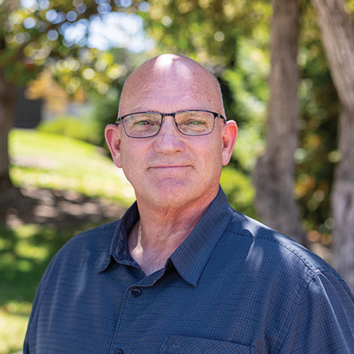
WUI Fire Institute director Frank Frievalt
Launched in 2022, the institute is a holistic, multidisciplinary effort to solve the growing threat of destructive fires crossing from wildlands into human population centers, causing loss of life and property, destroying communities and wreaking economic devastation.
For more than 40 years, Frievalt has been protecting the Western U.S. from wildfires, holding various leadership roles in Nevada and California fire departments before joining Cal Poly in 2022. He was drawn to the university because he felt its culture provided perfect conditions for facing one of the region’s biggest threats.
“Cal Poly has this deep DNA on applied research,” he said. “It’s something we do very well, and it’s the right culture in which to do the work.”
Garrett Lee, a third-year forestry and fire science major and the WUI Institute’s first student assistant, is working with a cutting-edge SIM Table, an augmented reality projector that maps real-world terrain and fire data onto a moldable sand surface. He’s using the tool to figure out how to disrupt fires that spread from structure to structure.
For decades, firefighters and other officials have used simple sand tables to model vegetation fires. A SIM Table allows visualization of the factors that shape how wildfires burn structures — and how they can skyrocket out of control. Lee reached out to the company that makes the devices to teach him how to use it and has been working with an applied geographic information systems (GIS) class that is using the table to model different scenarios. The goal is to make the table available to all students for research projects.
“When you use the SIM Table, you think about how this would apply to people in the community and then to the firefighters you’re training,” Lee said. “You’re using that SIM Table, not only as a method for our students to learn, but also to be better at the outreach on our other projects.”
“We need disruptive change enabled through an integrated plan between public policy and private markets to drive down the risk of life and property loss in the WUI.”
Frank Frievalt, director of Cal Poly's WUI Fire Institute
Lee’s work on the device is just one of the many research and outreach projects that the institute supports. He has known he wanted to make a difference in the wildfire space since the summer of 2020, when he and his family were forced to evacuate from the Silverado Fire near Irvine.
“I was in shock at how close it came to my house,” Lee said, adding that when they returned a week later, their house was spared — even though dramatic images of the fire on the news made him fear the worst.
“I just thought that if these firefighters are willing to sacrifice to protect my home, then I want to do the same thing,” Lee said. “Being active and having a sense of stewardship and having a calling to help the community was really attractive to me.”
When he arrived at Cal Poly in the fall of 2022, his plan was to get a degree, get out of school and work as a firefighter for the Orange County Fire Authority. But then he heard about the WUI Fire Institute, and his curiosity was piqued.
“I sat down with Director Frievalt, and he started talking to me about the wildland-urban interface and why it’s so important that we’re doing so many projects on fire mitigation and different research for safety for firefighters,” Lee said. “It made me realize that there’s a lot more that goes into fire mitigation than just firefighting. I’ve been involved ever since.”
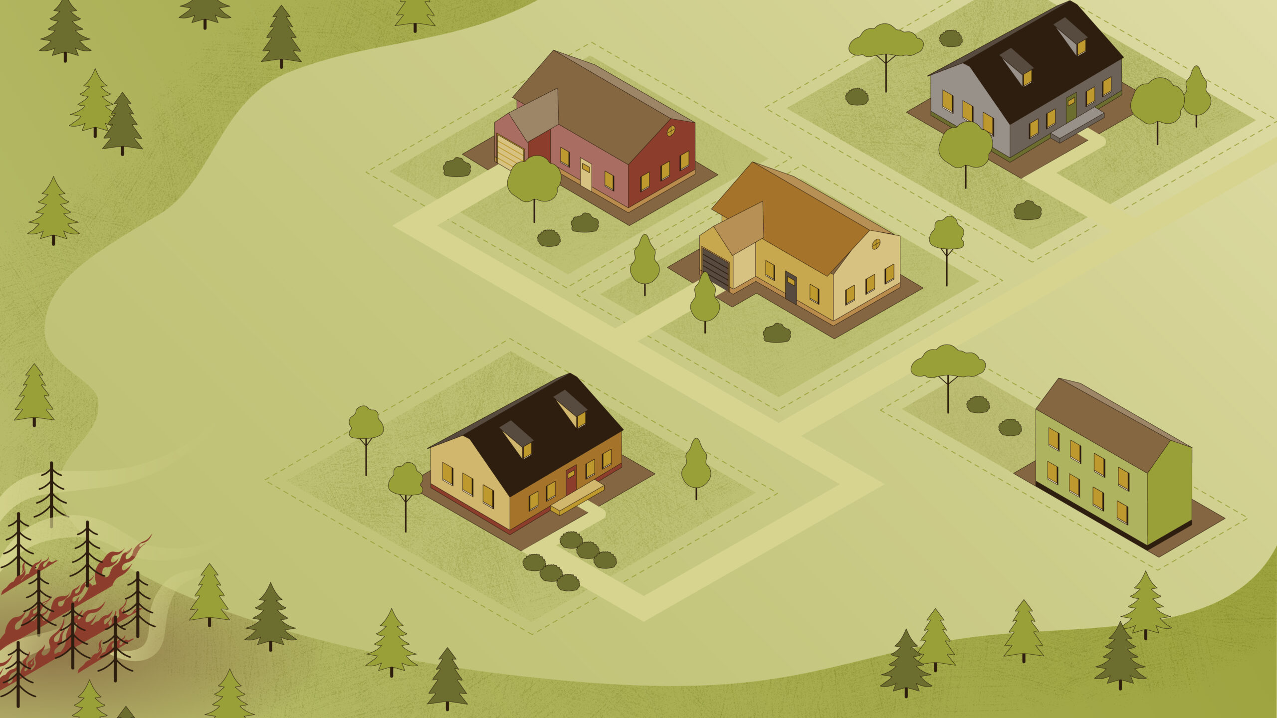
Earlier this year, Cal Fire released four rounds of color-coded fire hazard maps, which showed how much of California is vulnerable to devastating wildfire. The amount of area deemed to have either “high” or “very high” hazard grew by 168% since 2011, the last time the agency published fire hazard maps.
According to the maps, no areas around Cal Poly were found to be vulnerable to wildfire over a decade ago. Under the latest assessments, parts of campus and the hills around campus have come under “moderate” and “high” hazard.
The university is no stranger to the destruction of wildfire: In 2020, Cal Poly’s Swanton Pacific Ranch near Santa Cruz was devastated by the CZU Complex fire.
“We are a recovering community ourselves,” Frievalt said. “Our people are living through that loss, the recovery process and reenvisioning how we use that space in the future. We cannot rebuild it the way it used to be — we have to adapt for resilience just like any other recovering community.”
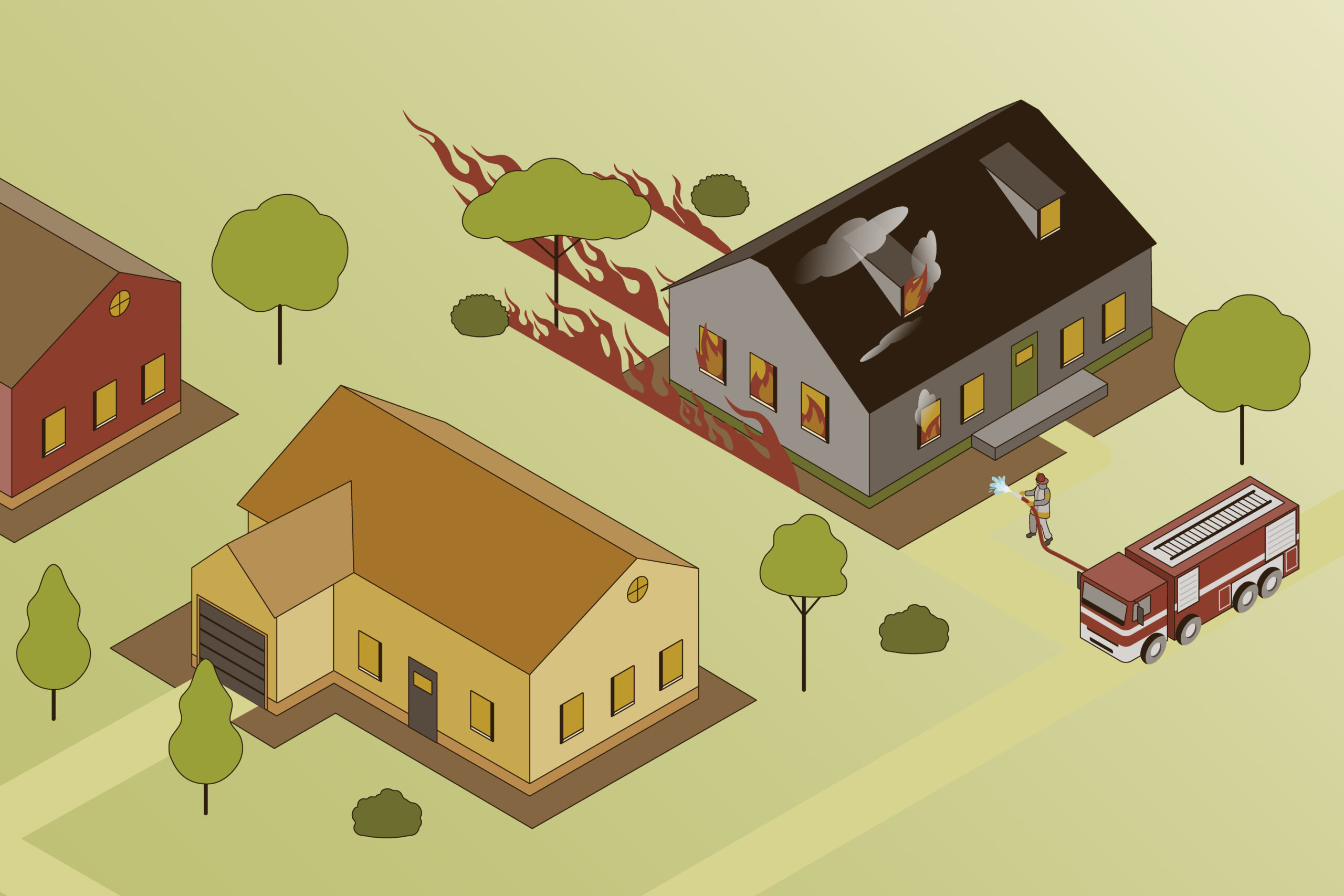
These issues are compounded by the history of wildfire and land management in the U.S. Decades of total suppression policies led to an unintentional accumulation of vegetation in the wildlands surrounding human communities, while climate change, urban development and density in fire-prone landscapes provided even more paths to destruction.
But more frequent and more destructive fires are only the beginning of the emerging crisis.
When Frievalt was the fire chief in Mammoth Lakes, California, just before coming to Cal Poly, he remembered that a few local homeowners passed the fire department’s defensible space inspection — meaning that they had properly controlled the vegetation around their properties.
But soon aft er the inspection, those residents received a non-renewal notice from their insurance carrier. The reason? Too much wildfire risk.
It’s becoming a common story in California. Thousands of homeowners were dropped from their insurance coverage ahead of the Los Angeles wildfires. State Farm announced in March that it would not renew 72,000 policies and enrollment in California’s insurer of last resort, the FAIR Plan, is surging due to rollbacks in insurance coverage.
This is in line with what is already happening in other states feeling the effects of climate change, like Florida, where many home insurers are at high risk of insolvency.
“Where do you place a mortgage holder who can’t afford a higher premium in a market that is writing less risk at higher prices?”
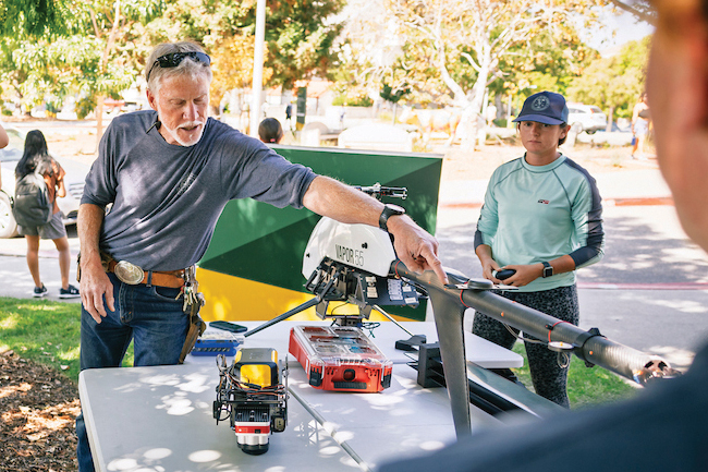
To combat these looming threats, the institute is working toward an overarching goal of creating the most fire resilient communities in the world. That involves a battle on multiple fronts: developing technological resources, training, education and public policy thought leadership to protect people, property and the environment.
While the institute is housed in the College of Agriculture, Food and Environmental Sciences, Frievalt describes it as a “transdisciplinary” and holistic project, built to leverage the expertise of faculty and students from every college on campus.
“Wildfire is a multi-dimensional phenomenon that requires participation from a broad range of constituencies,” said Margot McDonald, a professor of architecture who helped Frievalt build a coalition of faculty members to work with the institute. “We certainly have the right mix of disciplines at Cal Poly to contribute to solving the challenges that lie ahead.”
Besides Lee’s SIM Table work, other projects the institute supports include designing improved respiratory protection and other critical gear for firefighters, the development of a “living laboratory” in fuel treatment areas on Cal Poly property, and using drones to evaluate fuel characteristics near communities in the wildland-urban interface.
“It’s about developing current and future workforces,” Frievalt said. “We have to bolt on this competence to the existing workforce, and concurrently we have to build a new workforce.”
While modern land management practices have begun to adjust to the reality of more frequent fires in the wildland-urban interface, Frievalt says officials must also shift the way communities are built. Many grants designed to reduce the risk and consequences of our most destructive fires still operate under the assumption that the issue is primarily a problem of wildland fires encroaching on human settlements, which Frievalt calls “pre- 2017 thinking.”
Historically, agencies have also taken a disjointed approach to addressing factors that cause fires in the wildland-urban interface. Over the next few years, Frievalt plans to build the institute’s capabilities and set it up as the ultimate resource for fire departments, insurance companies, state and local governments and other stakeholders.
“We are laser-focused on reducing the loss of life and property in WUI communities,” Frievalt said. “We need disruptive change enabled through an integrated plan between public policy and private markets to drive down the risk of life and property loss in the WUI.”
If all goes well, and the work is done correctly, Frievalt predicts that people will one day watch a beneficial fire work its way past their community without fear of devastating loss.
“Honestly, up to this point it’s been a set of one-off solutions, technology silver bullets, where we keep redefining the problem or add some decimal points,” Frievalt said. “Approaching different parts of the problem from siloed areas of expertise ultimately leaves the complete solution to be sorted out somewhere else. The Cal Poly WUI Fire Institute is that somewhere else.”
By AnnMarie Cornejo
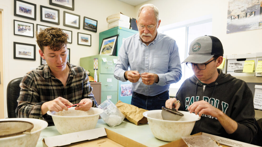
The Geospatial Systems Lab, launched by professor Marc Horney, uses LiDar (light detection and ranging) technology to scan complex, living landscapes and render them into virtual, three-dimensional representations of themselves at centimeter scales.
“We have faculty and students from every college on campus with more than 15 majors represented working on research,” said Horney. “That is the type of collaboration that is needed to solve problems as big as the ones we are facing.”
The lab is funded by the WUI Fire Institute, with additional support from the San Luis Obispo County Community Fire Safe Council. Research areas include fire and fuels behavior, ecosystem composition, landscape-level biomass estimation, watershed management and multi-temporal terrain modeling. One such project was recently done for the city of San Luis Obispo to map potential creek obstructions in an effort to minimize future flooding.
To date, the lab’s research team, which includes more than 20 student lab assistants, has covered 1,500 acres of landscape varying from rangeland to forest and has provided more than 200 hours of training in using the advanced remote sensing techniques to students.
“This is new technology and has a lot of different applications across many disciplines and industries,” said social sciences professor Andrew Fricker, a member of the lab team who teaches geographic information systems (GIS) courses. “Students are getting early exposure and a really valuable learning opportunity that not a lot of students have access to.”
Read more in the latest issue of Cultivate Magazine.
Students prepare artifacts for a historical exhibit, a record-breaking run, student journalists reach the hall of fame, a new app for Poly Canyon.
A food science course challenges students to learn how to cook for a variety of diets and budgets — and make it all taste good.